Project
Natlas
Year
2024
Service
Product Design
Natlas
Project Overview
An application that allows you to discover your surroundings in a different way with GIS data, with a carefully designed interface, in which users interact with the map and other users in real time.
Project Overview
An application that allows you to discover your surroundings in a different way with GIS data, with a carefully designed interface, in which users interact with the map and other users in real time.
The Problem
Exploring local surroundings often feels mundane or overwhelming due to the lack of engaging tools that combine real-time data, user interaction, and geographical context. Traditional maps and navigation apps are static and focused primarily on functionality, offering little in terms of social interaction or personalized discovery. As a result, users miss out on unique and dynamic experiences within their environment, leading to underutilized resources and a disconnected sense of place.
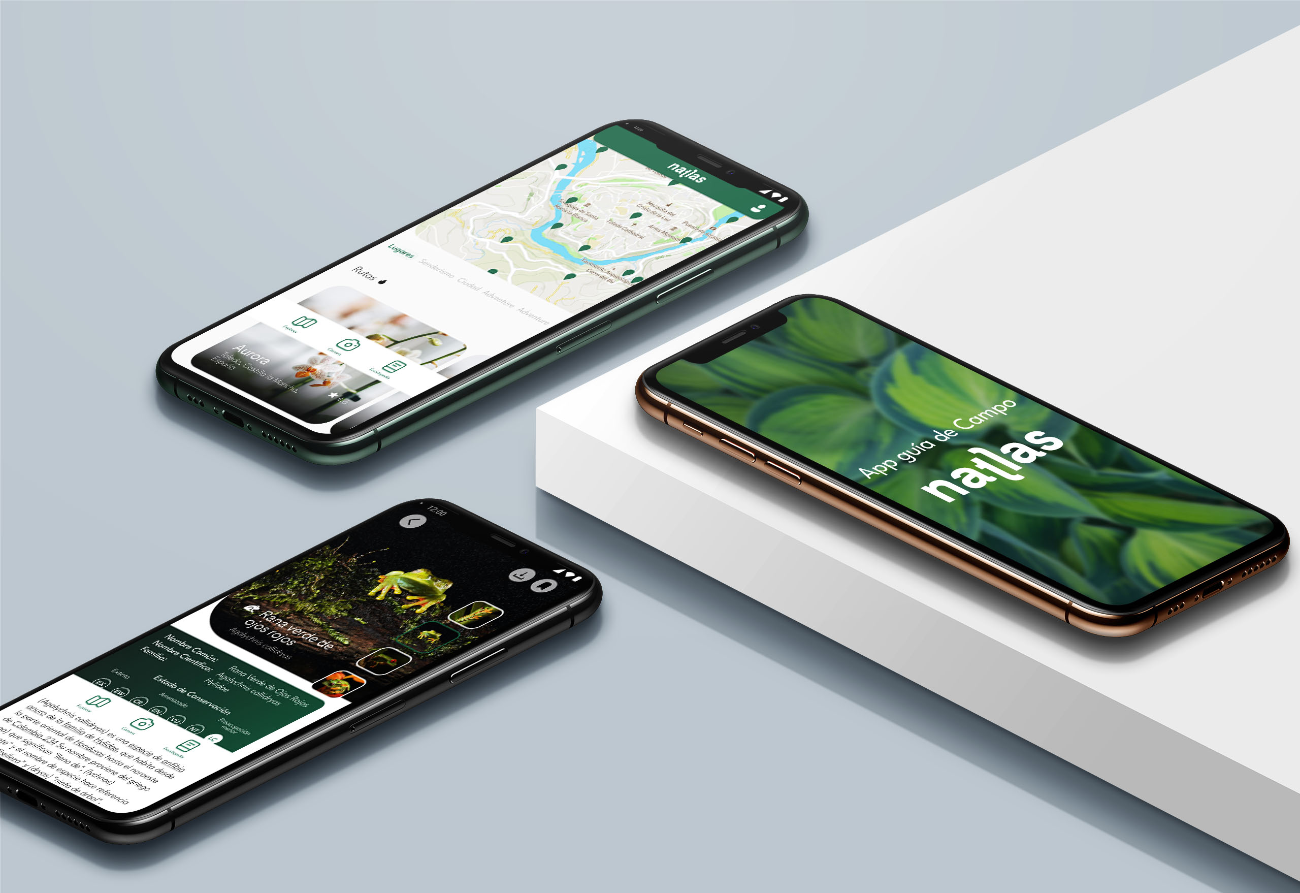
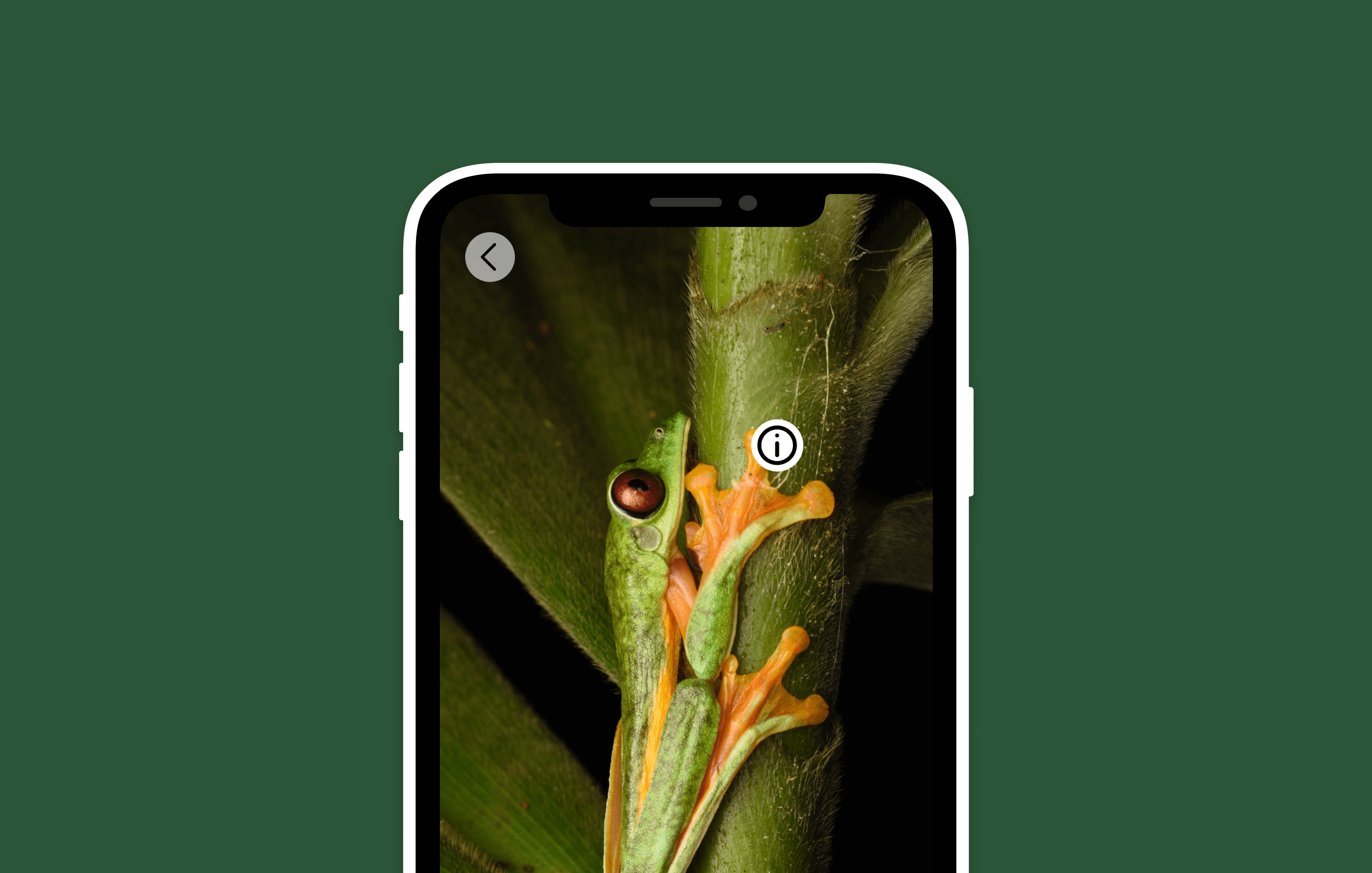
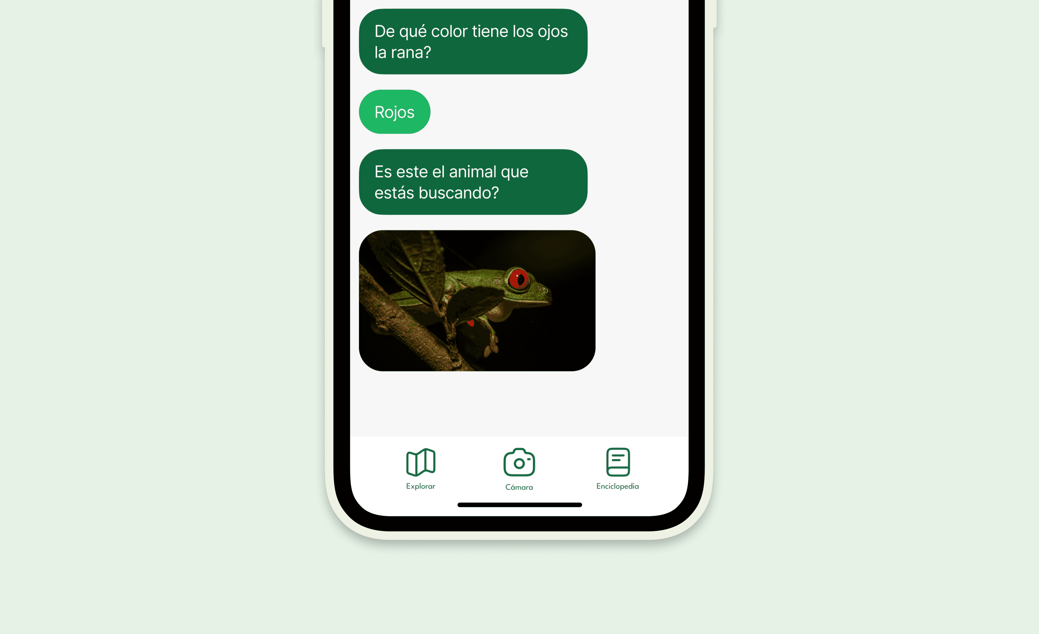
The Solution
This application redefines local exploration by integrating GIS data into an interactive and visually compelling interface. Users can engage with real-time map features, uncover points of interest, and connect with others through live interactions. The carefully crafted design fosters intuitive navigation, encouraging users to explore their surroundings dynamically. By combining spatial insights with social features, the app transforms everyday locations into vibrant hubs of discovery, fostering a deeper connection to one’s environment.
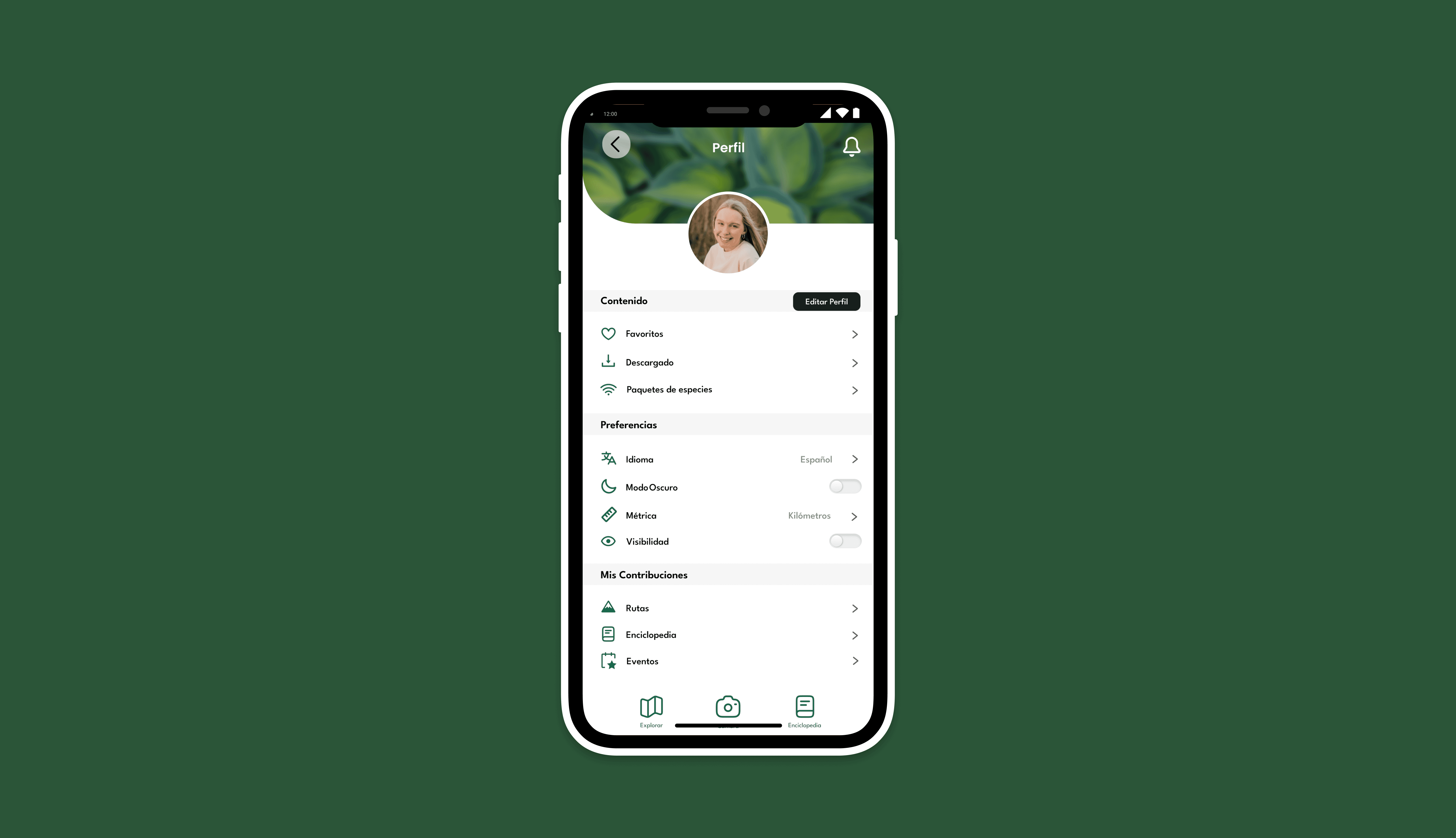
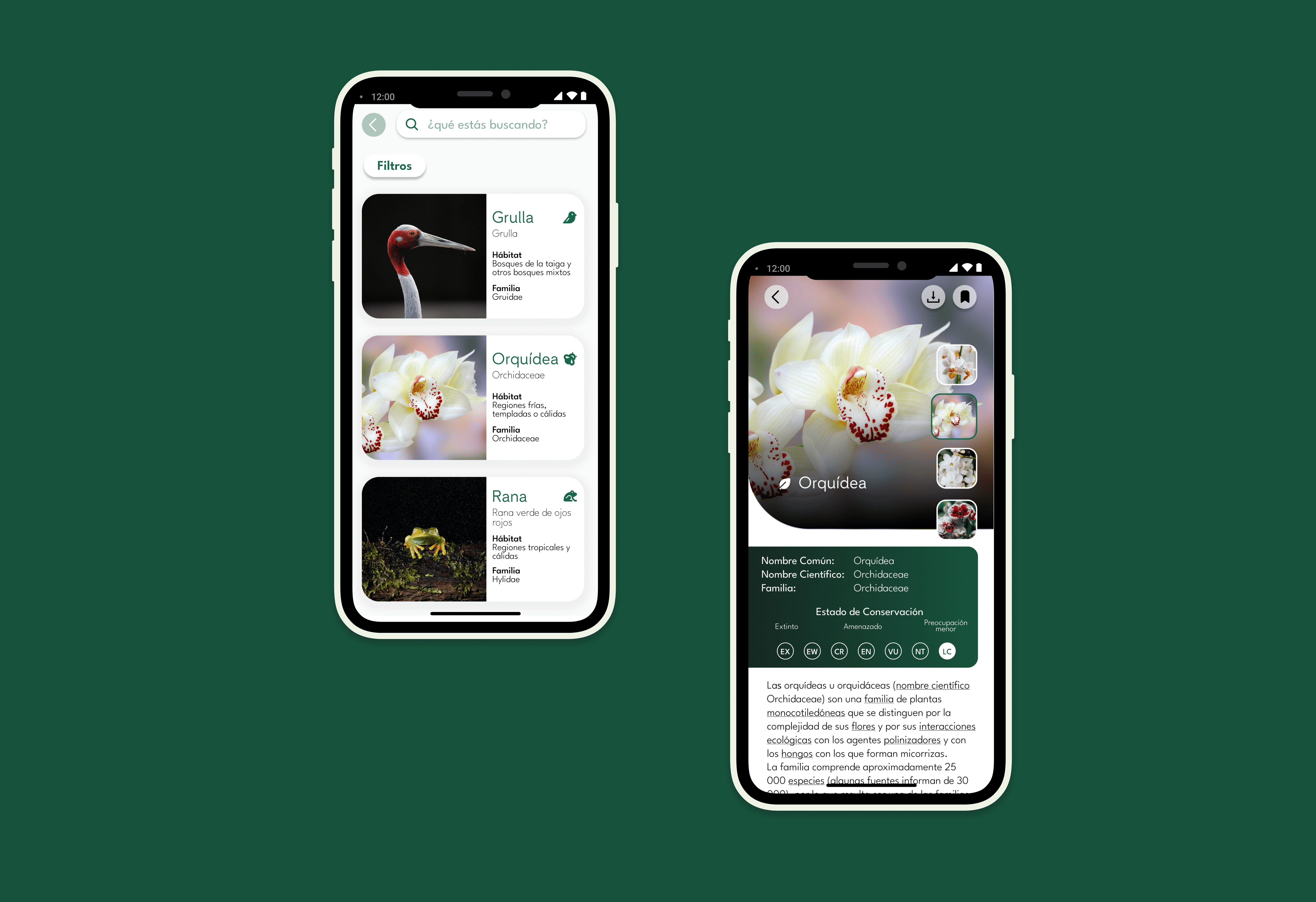
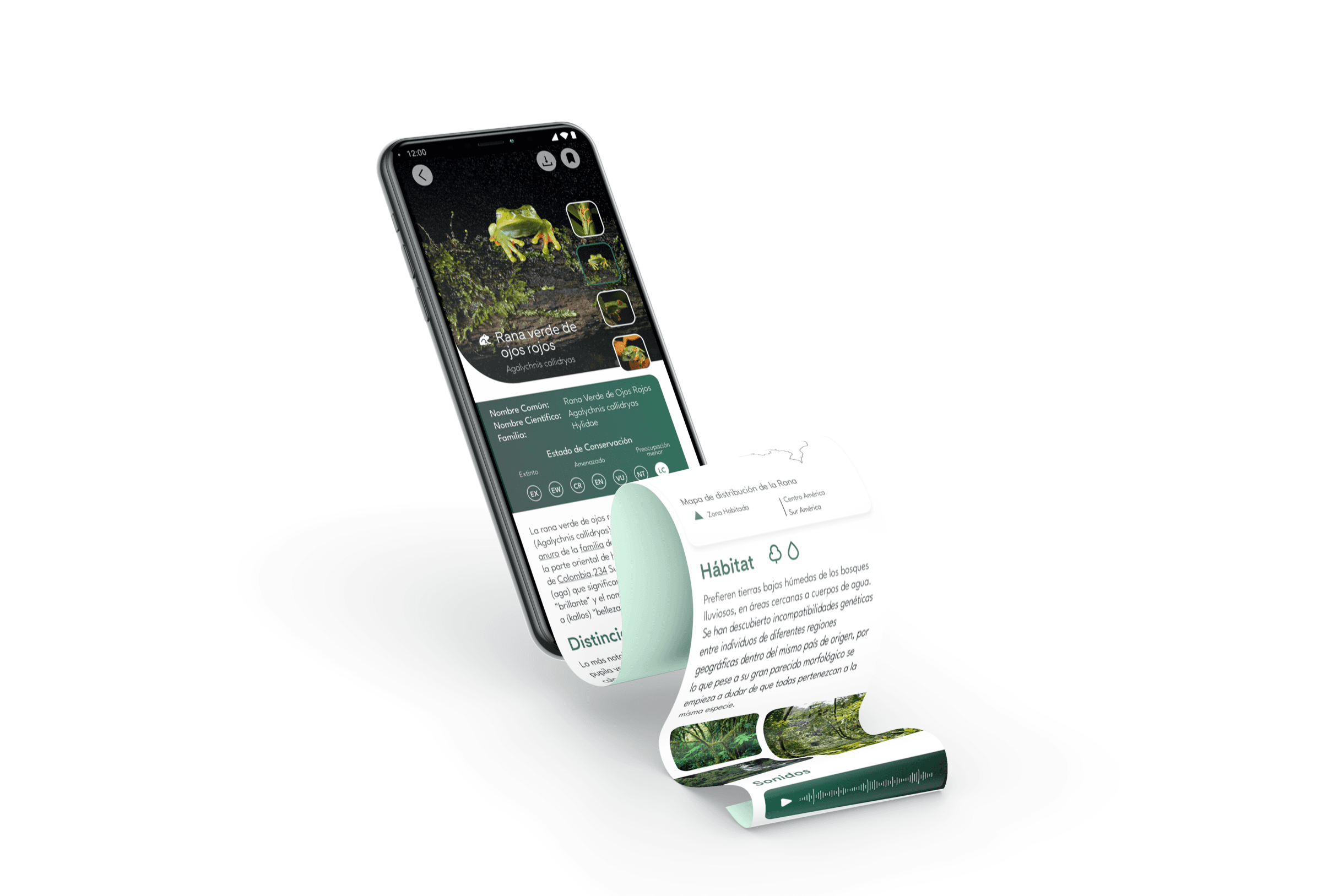
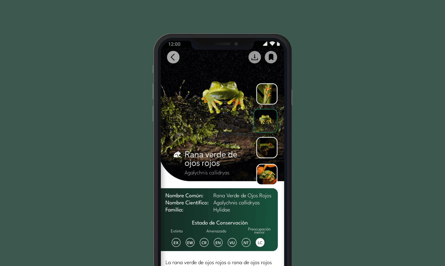
The Result
By prioritizing user-centered design principles, we developed an intuitive interface that simplifies navigation while enhancing discovery. The map serves as the central element, enriched with dynamic, visually appealing overlays and interactive features, allowing users to easily access relevant information about their surroundings. Social features were integrated thoughtfully, encouraging real-time interaction without overwhelming the primary navigation experience. The final design strikes a balance between functionality and aesthetics, offering users an innovative way to explore their environment while fostering a sense of community and connection.